R-GMT HexMap
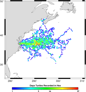
I’m just finishing up a contract making maps of telemetry data from satellite tagged animals. Basically just finding daily positions and making a pretty map out of them. It’s taken me a little while to write the code for it and while I’m not sure a whole lot of other people will be able to use it, I thought it might help one or two people out if I posted it online. The boss ended up wanting that as part of the contract too so pretty good motivation.
It’s not completely automatic but if you want pretty hexmaps of animal positions and you’re reasonably proficient in R (with maybe a little knowledge of GMT), then this may save you a good bit of time (or least let you skip some of the stumbling blocks I ran into). There’s also a function to read the output from the Douglas Argos Filter which could be handy if you’re working with Douglas filtered data in R.
The project page is here. Feel free to leave any comments or suggestions below.